
How Long Does It Take to Climb the Highest Peaks in Juneau, Alaska?
The Juneau, Alaska, area is home to rugged mountains, glaciated ridges, and dramatic peaks that invite hikers, mountaineers, and adventurers alike. If you’re visiting the region, you may wonder: how long does it take to climb Juneau’s highest summits?
We’ll profile several of the more prominent peaks around Juneau, estimate climb or hike durations (for suitable routes), examine seasonal factors, and offer tips for safely tackling these ascents. At the end, we invite you to stay with us at Juneau Hotel to make your mountain adventures more comfortable and convenient.
Setting expectations: Juneau’s terrain, access, and seasonality
Before diving into individual peaks, it is important to understand some constraints and caveats about climbing in the Juneau area.
First, Juneau lies within the Coast Mountains and boundary ranges, with heavy precipitation, glaciers, steep terrain, and variable weather. Mountain routes often traverse snow, ice, and unstable terrain. In many cases, glaciers, snowfields, or remnant ice may remain even in summer, depending on elevation.
Second, not all “peaks” have straightforward trails. Some summits are technical, require glacier travel, or are off-trail bushwhacks. When we speak of “how long” to climb them, we focus on the more accessible or semi-established routes. For more remote or technical climbs, times may vary widely.
Third, seasonality matters a lot. Summer (roughly mid-June through September) offers the most stable window for climbing and hiking, though even then, storms or snow can intervene. Winter climbs are far more challenging, requiring mountaineering skills, experience with snow and avalanche conditions, and possibly specialized gear.
With that in mind, let’s consider several of Juneau’s highest or most commonly climbed peaks.
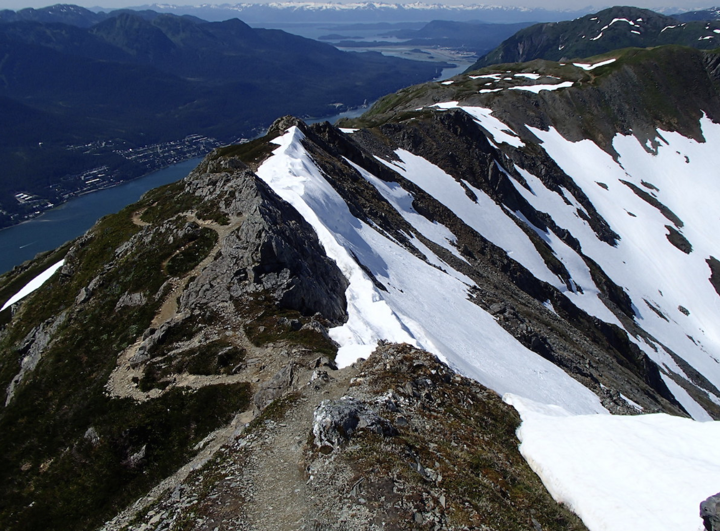
Mount Juneau
Elevation & general routeMount Juneau is one of the more accessible significant peaks directly overlooking the city. It is often accessed via the Perseverance Trail and a steep branch up the Mount Juneau Trail. The summit sits about 3,450 feet (or roughly 1,050 meters) above the valley.
Estimated timeMany hikers report completing the ascent (trailhead to summit) in about 3 hours and descending in roughly half that time, for a round-trip total of ~4.5 to ~5 hours. Other sources note that the full Mount Juneau hike (around 6 miles total and ~3,500 feet of elevation gain) may take up to 7 hours round-trip for some parties. Some climbers using the ridge route estimated ~90 minutes for the steep ridge segment (though that is a more aggressive pace).
Remarks & warningsThe route is steep, with switchbacks added to ease the gradient over time. Avalanche danger may persist in late spring on steep slopes. Use extra caution on snow or wet rock; stick to established trails. Some hikers criticize calling it a “2-hour hike” as overly optimistic for many parties, given the steep and sustained uphill.
Best seasonMid-June through early September is optimal. Outside that window, lingering snow or poor conditions make it riskier.
Gastineau Peak
Elevation & routeGastineau Peak lies adjacent to the popular Mount Roberts / tram area. One commonly cited route involves hiking up, and at the conclusion, riding the tram down to save elevation.
Estimated timeAt a steady pace, climbers generally report ~4 hours to ascend; with the tram ride down, that makes for a more convenient descent option.
Remarks & tipsBecause part of the climb may be done on established trails and with tram support, this peak is more accessible to many hikers. Still, it is steep and strenuous in parts.
Mount Roberts (to the tram and beyond)
Elevation & routeMount Roberts has the advantage of the Goldbelt Tram, which lifts you partway up, shortening the vertical climb. The trail from the tram station leads upward via steps, switchbacks, and ridge traverses to further ridgelines (e.g., to Gastineau Peak).
Estimated timeHiking up from the base (not using the tram) is a serious trek: it is about 2+ miles with roughly 1,700 feet of gain. Reviews mention the trail is a “serious trek almost entirely uphill.” Taking the tram reduces time and effort significantly. Many visitors ride the tram up and make short hikes from that point.
Remarks & tipsThe tram makes this peak relatively more accessible for skimming views or doing shorter hikes. But if you aim for the full ridge travel beyond where the tram takes travelers, expect steep terrain and variable footing.
Mount Jumbo (Bradley)
Elevation & routeMount Jumbo (often referred to as “Jumbo”) is another of the popular summit goals. The trail is roughly 5.5 miles out-and-back.
Estimated timeBecause the distance is moderate and the terrain steady, many hikers complete it within half a day – maybe 4 to 6 hours round trip, depending on pace, fitness, and conditions. The “challenging route” descriptor suggests a demanding but doable day hike.
Higher peaks: Icefield summits and remote climbs
If you aim for peaks in the Juneau Icefield and boundary ranges, expect far greater commitment. These include peaks such as Mount Blachnitzky, Emperor Peak, and Cathedral Peak. These are glaciated and remote, requiring significant logistical preparation, route finding, glacier travel, and often multi-day efforts.
Mount Blachnitzky (6,552 ft) sits between Gilkey Glacier and Avalanche Canyon. Its first recorded ascent occurred in 2004 via the south ridge.
Emperor Peak (6,805 ft) is glaciated and lies along the Taku Range corridor of the Juneau Icefield.
Cathedral Peak (6,500 ft) is part of the Taku Range and requires glacier approach and technical terrain.
If conditions, access, and route complexity permit, a climb may take multiple days (with overnight camps), and may require mountaineering gear. Be very conservative in planning. Because local sources do not provide consistent “time estimates” for these peaks, climbers should consult trip reports and glacier travel guides. SummitPost has listings of Juneau area peaks and route descriptions.
Factors that alter climb time significantly
When estimating a climb time, keep in mind the following variables that can cause big deviations:
Fitness, group pace, and rest breaksEven well-conditioned hikers differ. Breaks, camera stops, route finding, and fatigue slow you down.
Trail condition and snow/ice coverEarly in the season or after heavy weather, snow or ice may remain, requiring slower travel, crampons, or route changes.
Weather and visibilityFog, rain, wind, or cloud cover degrade speed and safety.
Route finding or deviationsSome climbs have offshoots, side routes, or confusing sections. Staying on track matters.
Descent difficultyDescending steep, rocky, or muddy trails may take almost as long asthe ascent, especially on tired legs or wet conditions.
Glacier or technical terrainIf glacier travel is involved, rope teams, crevasse hazard, scouting routes, and safety protocols all add time.
Sample climb time summary (approximate)
Mount Juneau (via Mount Juneau Trail/ridge): 3 hours up, ~1.5 hours down (4.5–5 hours total) to up to ~7 hours in slower conditions.
Gastineau Peak: ~4 hours to summit (with descent aided by tram if used)
Mount Roberts (full trail): several hours depending on starting point; using tram shortcut reduces time
Mount Jumbo: 4–6 hours round trip
Remote Icefield peaks (Blachnitzky, Emperor, Cathedral): multi-day efforts, dependent on access, glacier terrain, and route
Best seasons and planning tips
When to climb Mid-June through September offers the best window. Snow and avalanche risk decline; daylight is long; weather is more forgiving.
Pre-planning
Check local reports, trip logs, or maintenance updates
Know current snowpack, glacier conditions, and weather forecasts
Bring maps, GPS, and route descriptions
Let someone know your itinerary
Gear essentials
Layered clothing, rain gear, and wind protection
Good boots, traction devices, possibly crampons or microspikes
Trekking pole(s)
Navigation tools (map, compass, GPS)
Extra food, water, and an emergency kit
For glacier or technical climbs: rope, harness, ice axes, crevasse rescue gear
Start earlyBegin as early as possible to allow for delays and safe descent in daylight.
Descent marginDo not underestimate descent time. Tiredness, erosion, or route complexity often slow return.